
Buy PDF guide

Buy PDF guide — 17.14 USD

PDF — 17.14 USD

Swiss Alps Zurich - Lucerne - Interlaken - Zermatt Campgrounds, parking lots.

Swiss Alps Zurich - Lucerne - Interlaken - Zermatt Campgrounds, parking lots.

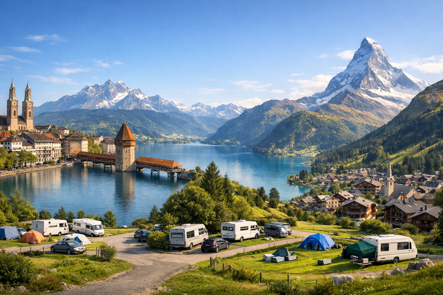
Journey through the heart of the Swiss Alps from stylish Zurich and lakeside Lucerne to the dramatic peaks of Interlaken and Zermatt. Along the way, scenic campgrounds and convenient parking stops make it easy to soak up mountain views, clear lakes, and storybook villages at your own pace.

🚗 DAY-BY-DAY ROUTE

Ready-made country and city routes with daily plans, sights, transport and accommodation. Buy PDF guides for independent travel.

🚗 DAY-BY-DAY ROUTE


Day 1 — Zurich: start of the road trip and a gentle introduction to the route

  • 🚗 Start: Zurich Airport or city center. Finish: Zurich. Approximate distance for the day — 25–40 km, pure driving time — about 45–70 minutes depending on parking and traffic. This is a day without a long transfer: you pick up the car, check the insurance, vignette, and body condition, then do a short loop along the waterfronts and viewpoints of the city. Main stops by car: parking near the Wollishofen district, the Lake Zurich promenade, and an evening drive up to Uetliberg or a viewpoint on the hill above the city. Parking in the center is strict: it is better to use covered parking garages rather than look for a spot on the street. Zurich has many time limits, white and blue zones, so for the first day it makes more sense to leave the car in an official parking garage and explore on foot. Overnight stay — in a city hotel; for travelers with a tent or motorhome, there is a real urban campsite, Fischers Fritz, by the lake. The day is realistic for an average driver because it is not overloaded: after a flight, there is no need to head straight into the Alps, and adapting to Swiss parking and driving rules happens calmly.


Day 2 — Zurich → Lucerne: lakeside road and old town

  • 🚗 Start: Zurich. Finish: Lucerne. Approximate distance — 55–75 km depending on the detour via Zugersee, pure driving time — 1–1.5 hours. To make the day more beautiful, do not rush along the fastest highway: you can make a scenic stop on the shores of Lake Zug or visit a small town on the way. Main stops: lakeside promenades, a viewpoint on the road south, and parking near Lucerne’s historic center. In the city, it is better to leave the car in a parking garage and continue on foot to Chapel Bridge, the Reuss waterfront, and the old town. Road details: Swiss motorways require a vignette; in central Lucerne it is more convenient to use official parking garages rather than street spaces. For camping, an excellent option is TCS Camping Luzern-Horw on the lake shore, a little outside the center but convenient for motorists. The day is comfortable and realistic: a short transfer, a beautiful finish by the water, and enough time for a walk without fatigue.

Day 3 — Lucerne: loop around the lake area and mountain panoramas

  • 🚗 Start: Lucerne. Finish: Lucerne. Approximate distance — 70–120 km, pure driving time — 2–3 hours. This is a day for lakeside roads, relaxed stops, and beautiful views of Central Switzerland. Main stops can be arranged like this: Verkehrshaus der Schweiz or the Lucerne waterfront in the morning, then a loop along Vierwaldstättersee, viewpoints by the lake, and quiet villages along the way. If you want an alpine drive without extra stress, a trip toward Bürgenstock or the panoramic roads around the lake with a return to Lucerne by evening works well. Road details: around the lake there are narrow sections, tunnels, and local speed limits; parking at popular spots fills up quickly by midday. Before setting out, it is convenient to refuel in the city area, and at night leave the car again in an official parking garage or at the campsite base. This day is realistic because it gives a break before the Bernese Oberland: the driver does not get tired, but already gets a real alpine picture.

Day 4 — Lucerne → Interlaken via Brünig Pass: the first major alpine highway

  • 🚗 Start: Lucerne. Finish: Interlaken. Approximate distance — 95–115 km, pure driving time — about 1.5–2 hours. The ideal transfer via Brünig Pass is not an extreme serpentine road, but a beautiful all-season pass road that is very suitable for an average traveler. Main stops: turquoise Lake Lungern, the Brünig Pass area, and viewpoints above Brienzersee before entering Interlaken. Along the way, you will often want to stop for photos, but this should only be done in official pull-offs and parking areas. After arriving in Interlaken, you can leave the car and walk around Höhematte or to the waterfront. Overnight stay — in a hotel in the center or at TCS Camping Interlaken by the Aare River. The day is realistic: the distance is small, the pass is easy, and there are enough stops so the road does not turn into a race.

Day 5 — Interlaken: lake road trip, waterfalls, and valleys of the Bernese Oberland

  • 🚗 Start: Interlaken. Finish: Interlaken. Approximate distance — 90–140 km, pure driving time — 2.5–3.5 hours. The best option for a driving day is to make a loop through one of the valleys: Interlaken → Lauterbrunnen → Stechelberg or Interlaken → Iseltwald → Brienz → Giessbach. Main stops: Lauterbrunnen with parking at the valley entrance, Staubbachfall, then return via the lakeside roads; alternatively — Giessbach Falls and the Brienz waterfronts. Road details: the roads in the valleys are good, but in summer and on weekends there can be heavy tourist traffic; in Lauterbrunnen and near the waterfalls, early parking is important. If you want less stress, it is better to leave before 9 a.m. For the driver, the day is very realistic: short stretches behind the wheel alternate with walks, and spending the night at the same base again saves you from packing your luggage.

Day 6 — Interlaken → Zermatt valley: a long but logical transfer to Täsch

  • 🚗 Start: Interlaken. Finish: Täsch / access area to Zermatt. Approximate distance — 150–180 km, pure driving time — 3–4 hours depending on the chosen route and traffic. The most realistic route for an average driver is along valley and main roads via the Spiez area and then into Upper Valais, without trying difficult high mountain passes out of season. Main stops: viewpoints at Thunersee, a short break in the Rhone Valley area, and finish in Täsch, where the car stays before the trip to car-free Zermatt. The most important road detail: regular tourist cars do not drive into Zermatt itself, so the final base for the car is Täsch. It is most convenient to park at Matterhorn Terminal Täsch or Parking Schaller and then continue by shuttle to Zermatt. If you do not want to carry a lot of luggage, it is worth packing a separate small bag for 2 nights. The day is realistic because it is the only truly long transfer, but it leads to the most spectacular alpine part of the route and does not require difficult mountain driving skills.

Day 7 — Zermatt without a car: Matterhorn, panoramas, and rest for the driver

  • 🚗 Start: Täsch. Finish: Täsch. Approximate distance by car — 0–10 km, pure driving time — minimal. This is intentionally a light day: the car stays in the parking lot, and you take the shuttle to car-free Zermatt. The main stops are no longer road-related but scenic: Zermatt center, viewpoints of the Matterhorn, the Matterhorn Paradise lifts, or the Sunnegga area depending on weather and budget. A day like this is important for safety and comfort: after the long transfer the day before, the driver rests, and the experience does not become any poorer. Overnight stay makes sense either in Täsch near the parking and railway terminal, or in Zermatt itself if you want to spend the evening among alpine chalets. For camping in this part of the route, it is better to focus on Täsch rather than Zermatt itself. The day is realistic because it does not break the logic of a road trip: the car stays where it is supposed to, and the difficult access to the mountain resort is solved by public transport.

Day 8 — Täsch / Zermatt valley → Zurich: return via main roads with a final lakeside pause

  • 🚗 Start: Täsch. Finish: Zurich or Zurich Airport. Approximate distance — 230–260 km, pure driving time — 4–4.5 hours. This is the final day, so it is better not to plan too many stops. Main stops: a short coffee break in the Valais valley, a motorway service area, and, if time allows, a final stop by the lake in the Zurich area before returning the car. Road details: it is better to leave early so you can calmly cover the long motorway section; before returning the car, it is convenient to refuel near the city or airport and check the return conditions. If you are traveling in summer, do not try to add a high pass just for a photo — the direct road is safer and more predictable. The day is realistic for an average driver: it is a long but straightforward motorway transfer with good infrastructure that finishes the route without night driving and without unnecessary risk.

Flight tickets

eSIM for travel

Buy PDF guide

Buy PDF guide — 17.14 USD

PDF — 17.14 USD