
Buy PDF guide

Buy PDF guide — 12.85 USD

PDF — 12.85 USD

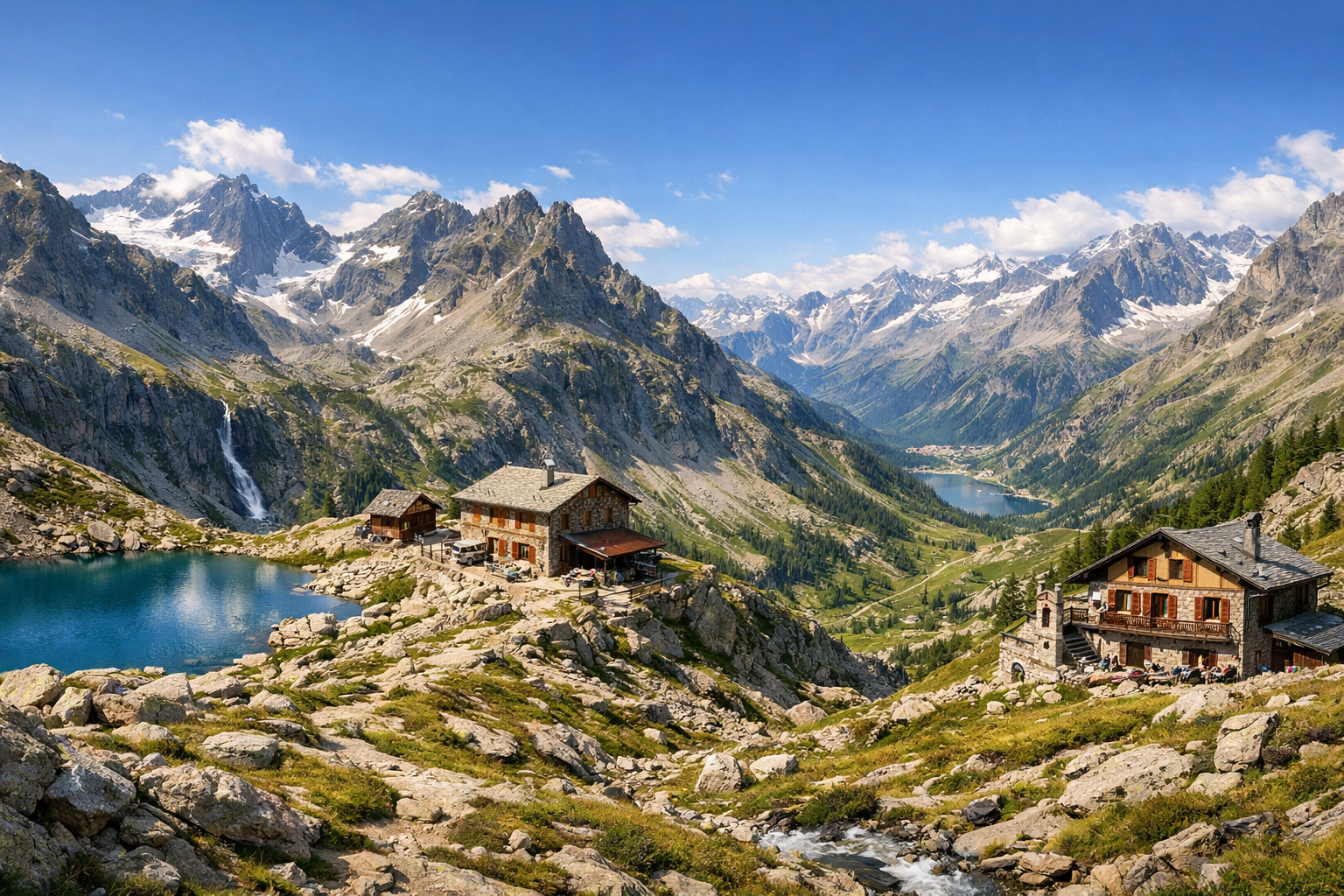
Italy, Gran Paradiso National Park. A six-day circular trek through the Valsavarenche and Val di Rhêmes valleys, high mountain passes, alpine lakes, and mountain huts. Difficulty: medium or high. Season: July - August.

Italy, Gran Paradiso National Park. A six-day circular trek through the Valsavarenche and Val di Rhêmes valleys, high mountain passes, alpine lakes, and mountain huts. Difficulty: medium or high. Season: July - August.

Discover Italy’s wild Alpine heart in Gran Paradiso National Park on a six-day circuit through Valsavarenche and Val di Rhêmes. Crossing high passes, skirting clear mountain lakes, and linking remote rifugi, this medium to challenging summer trek is made for hikers who want big scenery and long, rewarding days.

🥾 ROUTE BY DAY

Ready-made country and city routes with daily plans, sights, transport and accommodation. Buy PDF guides for independent travel.

🥾 ROUTE BY DAY


Day 1 — Valsavarenche: valley trail Dégioz → Rovenaud

  • 🥾 A gentle start to the route through the forest and valley section of the national park. After arriving in Valsavarenche, it is best to begin with a nature walk along the lower part of the valley between Dégioz and Rovenaud: this is a convenient marked trail among larches, meadows, streams, and old alpine villages. The active part of the day usually takes about 2.5–4 hours depending on pace and stops, the distance is roughly 7–10 km, and the elevation gain is small — approximately up to 250 m, with easy difficulty. The route is suitable for an average tourist without special equipment because it follows well-defined trails and rural paths with no technical sections. Along the way, it is convenient to stop by the visitor center in Dégioz and the center in Rovenaud, connected with the theme of water and biodiversity. In July and August it is already warm here during the day, but mornings can be cool; this is a good day for acclimatization before the higher passes. If there were heavy rains the day before, the trail may be wet in places, so footwear with good grip is important.


Day 2 — Valsavarenche: Pont → Rifugio Vittorio Emanuele II

  • 🥾 One of the park’s best-known yet accessible mountain hikes: the ascent from Pont to Rifugio Vittorio Emanuele II. This is already a true mountain day with wide views over the valley, rocky slopes, alpine meadows, and the Gran Paradiso massif, but without going onto the glacier and without mountaineering. In the usual format, the out-and-back walk takes about 4.5–6 hours, the distance is around 10–12 km, elevation gain is about 750–800 m, and the difficulty is moderate or closer to high for an unprepared tourist only because of the length and altitude. The route is very popular, well marked, and often used as a regular day hike to the hut, so it is suitable for tourists without special gear, as long as they do not continue farther toward the mountaineering route to the summit. The best start is early in the morning, before the trail heats up and before thunderclouds appear. In July–August the high-altitude section is usually accessible, but after a snowy winter there may be lingering snow above roughly 2500 m early in the season; it is worth checking trail conditions with the park or at your hotel. At the hut you can take a long scenic break and return the same way.

Day 3 — Valsavarenche: Pravieux → Rifugio Chabod and high-mountain views

  • 🥾 The second strong hiking day in Valsavarenche is the ascent from Pravieux to Rifugio Federico Chabod. This trail is more beautiful in terms of changing scenery: the forest quickly drops below, and pastures, moraine slopes, panoramas of the glacier side of the massif, and broad valley views open up. The active part of the day usually takes 5–6.5 hours round trip, the distance is about 11–13 km, elevation gain is around 850–950 m, and the difficulty is moderate/high. The route is suitable for an ordinary tourist specifically as a day ascent to a mountain hut: the trail itself is known, marked, and does not require a helmet, rope, crampons, or glacier travel if you limit yourself to visiting the hut and do not continue onto mountaineering options. This is a good day for those who want to feel more of the “big mountains” while staying within the bounds of safe trekking. Seasonal nuance: after lunch, clouds and short thunderstorms are possible, and at altitude the wind is noticeably stronger than below. You need water, a windbreaker, and enough time for an unhurried descent.

Day 4 — Transfer to Val di Rhêmes: Thumel → Rifugio Benevolo

  • 🥾 Transfer to Val di Rhêmes and a gentler but very scenic mountain day. From the Thumel area, it is convenient to walk to Rifugio Gian Federico Benevolo along one of the region’s best-known and most user-friendly valley trails: along a stream, through meadow landscapes, past cascades of water, and beneath an amphitheater of high peaks. Usually the out-and-back walk takes 3–4.5 hours, the distance is about 8–10 km, elevation gain is roughly 400–500 m, and the difficulty is easy or moderate. This is one of the best routes for ordinary tourists without special gear: the trail is popular, clear, without exposed technical sections, and with a logical finish at the hut. The day works well as a “breather” between longer ascents, especially after the transfer between valleys. In July the alpine meadows here are often in bloom, while in August the air is drier and clearer. After heavy rain some sections may be wet, but overall the route remains safe with basic caution.

Day 5 — Val di Rhêmes: high-altitude lakes Lago di Pellaud and Lago Nero

  • 🥾 A day of alpine lakes and open panoramas. From the Pellaud or Thumel area, you can create a beautiful circular or linear hike to Lago di Pellaud and farther toward Lago Nero along well-known mountain trails of Val di Rhêmes. This route is already noticeably more athletic, but still without technical mountaineering: about 5–6.5 hours of active walking, a distance of around 11–14 km, elevation gain approximately 650–850 m, and moderate difficulty. The character of the walk is valley, subalpine meadows, rocky high-altitude sections, lakes, and viewpoints. For an ordinary tourist, the route is suitable provided you have normal fitness and dry weather: the trails are marked, navigation is clear in season, and the sections do not require special equipment. It is only important not to head onto higher pass branches if there is snow, fog, or fatigue. The best departure time is early morning in order to cross the open sections before possible afternoon thunderstorms. In July there may be snow along the lake shores after a snowy winter; in August the trail is more often clearer and the weather more stable.

Day 6 — Return to Valsavarenche: Pont and the Nivolet lakes

  • 🥾 A final day with wide views and the feeling of a high mountain plateau: a walk in the Pont area and, if logistics allow, to the upper scenic sections toward Colle del Nivolet and the lakes Lago Serrù / Lago Agnel along safe tourist trails and walking paths without difficult sections. This is not a mountaineering day, but a panoramic hike in an area of high meadows, stone cirques, and lakes. Depending on the chosen option, the active part takes 3–5 hours, the distance is about 7–11 km, elevation gain is roughly 250–500 m, and the difficulty is easy or moderate. Such a finale suits an ordinary tourist because the route can be shortened flexibly, and the main panoramas are accessible without crossing dangerous ridges and without a glacier. It is very important to take seasonal access and parking rules on the Nivolet route into account: in the summer season there are environmental restrictions and free shuttles on part of the road, so the schedule must be checked in advance. In July and August the lake scenery is especially beautiful here, but at altitude even in summer there may be cold wind and sudden weather changes.

Flight tickets

eSIM for travel

Buy PDF guide

Buy PDF guide — 12.85 USD

PDF — 12.85 USD