
Buy PDF guide

Buy PDF guide — 6.43 USD

PDF — 6.43 USD

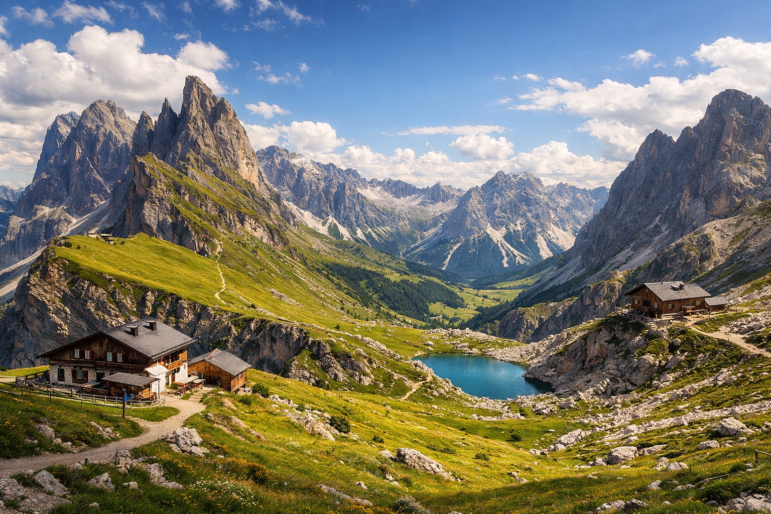
Italy, Dolomites. A three-day trek through the Puez-Odle Nature Park across alpine meadows, mountain passes, and the high-altitude Puez plateau with overnight stays in mountain huts. Difficulty: moderate or high. Season: July - September.

Italy, Dolomites. A three-day trek through the Puez-Odle Nature Park across alpine meadows, mountain passes, and the high-altitude Puez plateau with overnight stays in mountain huts. Difficulty: moderate or high. Season: July - September.

Hike through the heart of the Dolomites on a three-day journey from Ortisei to Val di Funes, crossing flower-filled meadows, dramatic mountain passes, and the stark beauty of the high Puez plateau. With nights in traditional mountain huts and big alpine views at every turn, this moderate to challenging trek is one of Italy’s most unforgettable summer adventures.

🥾 ROUTE BY DAY

Ready-made country and city routes with daily plans, sights, transport and accommodation. Buy PDF guides for independent travel.

🥾 ROUTE BY DAY


Day 1 — Ortisei / Santa Cristina: Col Raiser → Seceda → Rifugio Puez

  • 🥾 Today the real Dolomites journey begins: from the Val Gardena valley, it’s convenient to take the Col Raiser cable car from Santa Cristina so you don’t waste energy on a long forest ascent below and can instead start right away among alpine meadows, pastures, and broad panoramic trails. The active part of the day usually takes about 5–6.5 hours without long breaks; the approximate distance is about 11–13 km, total elevation gain around 700–900 m, and the difficulty is moderate / leaning high due to the duration and altitude, but with no technical sections. The trail follows well-known marked paths through the Seceda area and then on to the high-altitude Puez plateau, where the landscape gradually changes from green meadows and gentle slopes to a harsher limestone wilderness. This is a route for an ordinary hiker without special equipment: no helmet, rope protection, via ferrata set, or ice gear is needed, but sturdy trekking boots, water, a rain jacket, and extra time are essential. In July, patches of snow may still remain on some shaded sections after a snowy winter, and in September the days are already shorter, so you should start early; it’s worth checking the last cable car and the ridge weather the day before. An overnight stay at Rifugio Puez makes the day especially atmospheric: in the evening the plateau empties out, and the Dolomite walls around you seem almost unreal.


Day 2 — High-altitude Puez plateau: Rifugio Puez → Forcella de Putia / Roa → Rifugio Genova

  • 🥾 The second day is the most “alpine” in mood, but it is still safe trekking on marked trails without mountaineering. You walk across the open high-altitude plateau, the rocky waves of Puez, saddle passes, and then gradually descend toward the green slopes of the Funes valley. The active part of the day usually takes 4.5–6 hours; the distance is about 10–12 km, the elevation gain is comparatively moderate at around 300–500 m, but there is a noticeable descent to Rifugio Genova / Schlüterhütte. The difficulty is moderate for a prepared hiker and moderately high for a beginner, mainly because of the length, altitude, and rocky surface rather than danger. This day is excellent for an ordinary traveler because the route follows the popular multi-day Alta Via 2 crossing and neighboring marked trails, where in season you often meet other hikers and do not need complex navigation. Important seasonal details: after rain, limestone and scree can be slippery, there is almost no shade on the open plateau during the day, and in fog navigation becomes slower, so an offline map and an early start are useful. An overnight stay at Rifugio Genova is especially pleasant because after the harsh plateau you return to grassy slopes and the famous views of Odle/Geisler.

Day 3 — Val di Funes: Rifugio Genova → Zanser Alm → nature trail and visitor center

  • 🥾 The final day is gentler and makes an ideal ending to the trek: in the morning you leave the hut and descend along a marked trail to Zanser Alm, passing through alpine meadows, sparse woodland, and open scenic sections with classic panoramas of the jagged Odle peaks. The descent to the parking area and bus stop usually takes about 2–3 hours; roughly this is 6–8 km and mainly a loss of around 600–700 m in elevation, so technically the route is easy / moderate, although your knees will feel the descent. After reaching Zanser Alm, you can add a short easy walk on the Zans Nature Experience Trail or stop by Naturparkhaus Puez-Geisler in Santa Maddalena — a good calm finish without overload. The day suits an ordinary traveler because you are no longer walking through remote high terrain but descending on popular and clear trails with bus access. Seasonal details: in July and August afternoon thunderstorms are possible, so it is better to descend in the morning; in September mornings can be cold, but visibility is often especially beautiful. If you plan to return by public transport, it is helpful to check the bus timetable from Zanser Alm in advance and not linger too long over a late lunch.

Flight tickets

eSIM for travel

Buy PDF guide

Buy PDF guide — 6.43 USD

PDF — 6.43 USD