
Buy PDF guide

Buy PDF guide — 8.57 USD

PDF — 8.57 USD

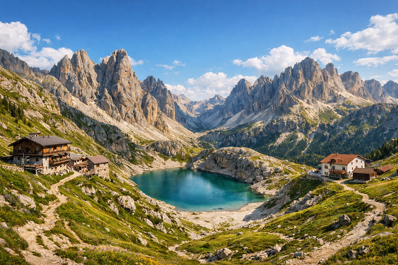
Italy, Dolomites. A four-day trek through Val di Fassa with crossings between mountain huts, over alpine passes, by Lake Antermoia and the Catinaccio massif. Difficulty: moderate or high. Season: July - September.

Italy, Dolomites. A four-day trek through Val di Fassa with crossings between mountain huts, over alpine passes, by Lake Antermoia and the Catinaccio massif. Difficulty: moderate or high. Season: July - September.

Cross the heart of the Dolomites on a four-day trek through Val di Fassa, moving hut to hut beneath the jagged towers of the Catinaccio massif. Alpine passes, high meadows, and the turquoise waters of Lake Antermoia make this a vivid mountain journey, best for strong hikers from July to September.

🥾 ROUTE BY DAY

Ready-made country and city routes with daily plans, sights, transport and accommodation. Buy PDF guides for independent travel.

🥾 ROUTE BY DAY


Day 1 — Vigo di Fassa → Ciampedie → Gardeccia → Rifugio Vajolet

  • 🥾 The tour starts from Vigo di Fassa with a cable car ascent to Ciampedie, then continues on foot through alpine meadows and rocky but well-marked trails toward Gardeccia and higher up to Rifugio Vajolet. This is a day in the format of a mountain walk through forest, meadows, and a high alpine valley with a very beautiful gradual entry into the Catinaccio massif. The active part usually takes about 4.5–5.5 hours without long stops; the distance is roughly 9–11 km, with an elevation gain of about 700–850 m depending on the exact start option and use of the lift. Difficulty is moderate. The route is suitable for a regular турист without special equipment because it follows popular trails to well-known huts, with no glaciers, no ferrata, and no technical mountaineering. Along the way there is conifer forest, streams, wide views of the Vajolet towers, and pale dolomite walls. In summer and early September it is important to start early: afternoon thunderstorms often build in the Dolomites, and in July lingering snow may remain on some shaded sections after a snowy winter. It is better to book the hut overnight stay in advance, especially for Fridays, weekends, and the whole period from mid-July to the end of August.


Day 2 — Rifugio Vajolet → Passo Principe → Lago di Antermoia → Rifugio Antermoia

  • 🥾 The main high-mountain day of the tour: a crossing between mountain huts over alpine passes and to one of the most beautiful lakes in the area — Lago di Antermoia. From Rifugio Vajolet the trail climbs to Passo Principe, then continues through a harsh but highly photogenic stone amphitheater to Passo d’Antermoia and descends into the quiet Vallon d’Antermoia to the lake and hut. The character of the hike is a high alpine valley, passes, rocky cirques, and an alpine lake. The active part usually takes 5.5–7 hours; the distance is roughly 10–12 km, with total elevation gain of about 700–900 m, plus a significant descent to the finish. Difficulty is moderate to high, but still within the range of classic hiking for a prepared hiker: the trails are well known and marked, but the day is longer and at higher altitude, so solid footwear, spare water, wind protection, and an early start are needed. Special equipment is not required in normal summer conditions if you do not take ferrata side routes and stay on the main walking route. The seasonal nuance is especially important: in July, after a snowy winter, snowfields may remain on the pass sections, and in September mornings can be very cold and windy; if the forecast is unstable, it is best to ask at the hut about trail conditions before departure. Lake Antermoia usually becomes the highlight of the day: the water lies in a basin beneath pale walls, and the valley itself feels wild yet accessible.

Day 3 — Rifugio Antermoia → Valon d’Antermoia → Passo Dona / Ciaregole → Val Duron → Rifugio Micheluzzi → Campitello di Fassa

  • 🥾 The third day is a long and very beautiful descent from the high mountains into a green valley. From Rifugio Antermoia the route goes through the rocky upper part of the valley, then crosses a pass section toward Val Duron and gradually leads to pastures, streams, and open meadows around Rifugio Micheluzzi, from where it is convenient to finish the day in Campitello di Fassa. The character of the walk is an alpine valley, pastures, mountain meadows, and a forest exit to a village. The active part usually takes 5–6.5 hours; the distance is roughly 12–15 km, elevation gain is moderate — about 300–500 m, but the descent during the day is noticeable. Difficulty is moderate. This day suits a regular hiker well because it follows a popular descent option into Val Duron without technical sections and without the need for protection or a helmet. On the lower part of the route the trail becomes gentler and more pleasant, and the Val Duron valley itself is considered one of the most scenic and friendly in Val di Fassa. In the height of summer it is warmer here than on the passes, so it is worth refilling water in the morning, and on stormy days not delaying your exit from the upper zone. If your legs are tired, from the Micheluzzi area it is sometimes convenient to use an allowed local shuttle or taxi on the lower section of the valley instead of walking the entire way.

Day 4 — Campitello di Fassa / Vigo di Fassa: an easy panoramic walk in Catinaccio via Gardeccia or Ciampedie

  • 🥾 The final day is made easier so that the route remains realistic after three transfer days. It is best devoted to a panoramic walk on the lower and middle trails of the Catinaccio massif: for example, take local transport up to the Ciampedie or Gardeccia area and walk one of the short scenic routes through meadows, forest approaches, and viewpoints with views of the valley and stone towers. The character of the walk is a panoramic mountain park, alpine meadows, forest, and viewpoints. The active part is about 2.5–4 hours; the distance is usually 6–8 km, with elevation gain of 250–450 m depending on the chosen loop. Difficulty is easy or moderate. This day is especially suitable for a regular hiker without special equipment: you can vary the route length depending on how you feel, avoid difficult upper sections, and simply enjoy the final panoramas of the dolomite walls. In July–September it is important to check lift operation and the last descent/return transport, and also keep in mind that clouds often cover the best views by evening. If the weather turns bad, this day can be shortened to a walk around Ciampedie and a visit to the tourist office to check future trail conditions.

Flight tickets

eSIM for travel

Buy PDF guide

Buy PDF guide — 8.57 USD

PDF — 8.57 USD