
Buy PDF guide

Buy PDF guide — 15.00 USD

PDF — 15.00 USD

Germany and Austria. Danube Cycle Path (Passau — Vienna). Season: May — September.

Germany and Austria. Danube Cycle Path (Passau — Vienna). Season: May — September.

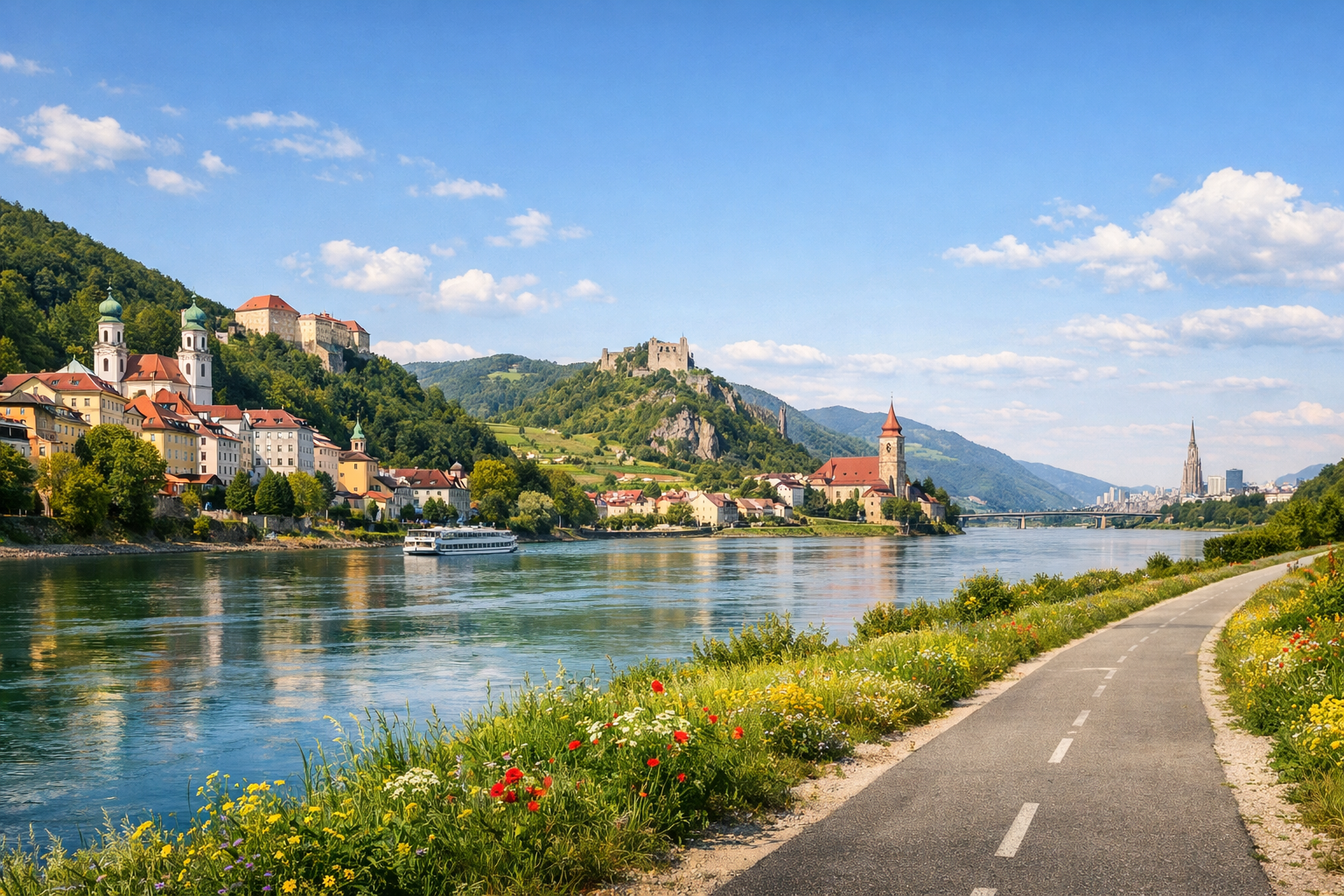
Ride one of Europe’s most beautiful river routes as the Danube winds from Passau through the dramatic Schlögen loop, past baroque towns, vineyards, and abbeys on the way to Vienna. From Linz and Grein to Melk and Krems, this classic ride is at its best from May to September, with long days, green riverbanks, and plenty of places to linger.

🚲 DAY-BY-DAY ROUTE

Ready-made country and city routes with daily plans, sights, transport and accommodation. Buy PDF guides for independent travel.

🚲 DAY-BY-DAY ROUTE


Day 1 — Passau → Schlögen: start on the classic Donauradweg

  • 🚲 Start in Passau, finish around the Schlögener Schlinge area. Roughly 42–48 km, pure riding time 2.5–3.5 hours, elevation gain is small — about 150–250 m, because the route mostly follows the river. The surface on this day is very friendly for a regular tourist: paved bike paths, embankments, separate sections of firm gravel, and quiet local roads. Difficulty is easy. Main stops along the way are Obernzell with its waterfront and historic center, Engelhartszell with its monastery and calm riverside atmosphere, and then the views before Schlögener Schlinge. Water and snacks are easy to restock in Passau before departure, then in Obernzell and Engelhartszell, where there are cafés, shops, and guesthouses. It is better to stay overnight right in Schlögen or nearby so you do not waste energy on an extra transfer in the morning. Road nuances: at the start, watch the urban navigation in Passau; after the border, the route becomes very clear; after rain, short gravel stretches can get muddy, and with a headwind even a flat day feels longer. This day is realistic for an ordinary cycle tourist because the distance is moderate, the profile is almost flat, and services along the way are frequent — it is the ideal gentle start to a week-long route.


Day 2 — Schlögen → Linz: grand river scenery and a comfortable long ride

  • 🚲 Start at the Schlögener Schlinge, finish in Linz. Roughly 54–60 km, pure riding time 3.5–4.5 hours, elevation gain about 200–300 m. The surface is mostly paved and very smooth: dedicated bike paths along the Danube, embankments, and local roads without heavy traffic. Difficulty is moderate only because of the day’s length. Main stops are the Schlögener Schlinge viewpoint itself, riverside villages along the way, and the approach into Linz along the well-developed Danube banks. For water and food, it is convenient to take a break in Aschach an der Donau or in one of the riverside villages along the route; on a hot day it is better to carry at least 1.5–2 liters of water because this section is very open and sunny. Staying overnight in Linz is a sensible choice: the city offers a range of hotels, services, bike shops, and railway backup in case of fatigue. Road nuances: the approach to Linz may feel a little busier visually, but the cycle route itself is well organized; in windy weather, exposed waterside sections can slow your pace. This day is realistic because the route is technically simple and almost without climbs, and 55–60 km on a flat, high-quality path is a normal distance for an ordinary tourist with basic fitness or on an e-bike.

Day 3 — Linz → Grein: the calm rhythm of Upper Austria

  • 🚲 Start in Linz, finish in Grein. Roughly 58–64 km, pure riding time 3.5–4.5 hours, elevation gain usually 180–280 m. The surface is once again very convenient: asphalt, bike paths along levees and the riverbank, and short sections on rural roads. Difficulty is moderate. Main stops are Mauthausen as a meaningful historical point, then the Naarn/Mauthausen floodplain areas, and the old town of Grein with its riverside frontage. Water and food can be restocked in Linz before departure, then in Mauthausen and in villages closer to Grein; in high season cafés and bakeries operate reliably, but on Sundays it is better not to rely only on small shops. It is best to stay overnight in Grein: this compact town works very well as a base before moving on to Lower Austria. Road nuances: the day is not difficult, but at urban exits and bridge junctions it is important not to miss the Donauradweg signs; in summer, exposed sections on the levees can be hot and almost without shade. This day is realistic because the terrain is gentle, there are enough stops along the way, and the mileage remains in a comfortable range for unhurried travel.

Day 4 — Grein → Melk: transition to Lower Austria

  • 🚲 Start in Grein, finish in Melk. Roughly 48–55 km, pure riding time 3–4 hours, elevation gain about 200–300 m. The surface is mixed but convenient: paved bike paths, river embankments, occasional firm gravel sections, and quiet rural access roads. Difficulty is easy or moderate depending on the wind. Main stops are Ybbs-Persenbeug or the dam/crossing area, then Pöchlarn, and the final approach to Melk Abbey. For a break, it is convenient to stop in Ybbs or Pöchlarn: it is easier there to find coffee, a supermarket, a bakery, and water. Staying overnight in Melk is especially logical because the town is compact, beautiful, and from here it is convenient to start into the Wachau region. Road nuances: when choosing a riverbank, it is better to follow the official Donauradweg navigation, because some local branches can lead you away from the most direct option; in rain, be more careful on short unpaved stretches and near river access points. The day is realistic thanks to the moderate distance and almost flat profile — it is a good chance to recover before the most photogenic section of the route.

Day 5 — Melk → Krems via the Wachau: the most beautiful day of the tour

  • 🚲 Start in Melk, finish in Krems. Roughly 38–45 km of pure riding, 2.5–3.5 hours in the saddle without long stops, elevation gain is small — about 150–250 m, if you do not ride high up into the vineyards. The surface is mostly excellent: paved Danube Cycle Path, embankments, and quiet local streets in wine villages. Difficulty is easy. Main stops are Emmersdorf/views of Melk Abbey, Spitz or Weißenkirchen, then Dürnstein with its famous silhouette and tower. For water and food, this is one of the easiest days of the whole trip: villages come frequently, with many cafés, heuriger taverns, bakeries, and places for a calm long break. If you want, you can use local ferries in the Wachau to see the other bank or make part of the route more scenic; before departure, you need to check the schedule because the ferries are seasonal. It is best to stay overnight in Krems or Krems-Stein: this is a large, convenient finish with hotels, bike service, and transport. Road nuances: the Wachau is very popular from May to September, so during the day you need to ride carefully in narrow spots and respect pedestrians; in high season there may be short queues for the ferries. This day is realistic because it is short, almost flat, and designed not for a sporty pace but for enjoying the landscape and historic stops.

Day 6 — Krems → Tulln: longer, but still very comfortable

  • 🚲 Start in Krems, finish in Tulln an der Donau. Roughly 50–58 km, pure riding time 3–4.5 hours, elevation gain about 120–220 m. The surface is mostly paved: levees, riverside bike paths, quiet rural roads, and in places straight and fast sections. Difficulty is moderate. Main stops are Traismauer as a convenient coffee break, the Roman and wine landscapes of the Wagram region, and then tidy Tulln with its pleasant urban waterfront. It is best to restock water and food in Krems before departure and then in Traismauer; between settlements the route can be calmer and more monotonous, so it is not worth setting out with just one small bottle. Staying overnight in Tulln is sensible because it shortens the final day to Vienna and lets you arrive in the capital without being tired. Road nuances: the day has almost no technical difficulties, but part of the route runs along very open riverside lines — in July and August it is important to start earlier, use sun protection, and keep an eye on the wind. This day is realistic because the route is longer only on paper: the profile is flat, the surface is good, and the route is intended specifically for cycle touring, not for a road race.

Day 7 — Tulln → Vienna: final arrival into the capital along the Danube

  • 🚲 Start in Tulln, finish in central Vienna via the Danube cycle routes. Roughly 38–45 km, pure riding time 2.5–3.5 hours, elevation gain minimal — usually up to 150 m. The surface is excellent: paved bike paths, river levees, urban cycle paths, and embankments. Difficulty is easy. Main stops are Klosterneuburg as a logical pre-entry to Vienna, the Danube island and floodplain sections before the city, and then the final approach to the center along the cycle route officially described as the Danube bike path to center of Vienna. Water and food are easy to get in Tulln, then buy more in Klosterneuburg or already in Vienna. It is best to stay in an area where it is easy to finish the trip and return the bike: Landstraße, Wien Mitte, Prater, or near major stations. Road nuances: when entering Vienna, the flow of cyclists becomes denser, urban traffic lights appear, and there are more pedestrians; you need to ride more calmly, especially on shared-path sections. This day is realistic for an ordinary cycle tourist because the distance is short, the profile is flat, and the finish is built around already developed cycling infrastructure rather than difficult urban traffic.

Flight tickets

eSIM for travel

Buy PDF guide

Buy PDF guide — 15.00 USD

PDF — 15.00 USD