
Buy PDF guide

Buy PDF guide — 23.56 USD

PDF — 23.56 USD

France and the Alpine Rings Tour du Mont Blanc (Classic Ring). Season (July - August)

France and the Alpine Rings Tour du Mont Blanc (Classic Ring). Season (July - August)

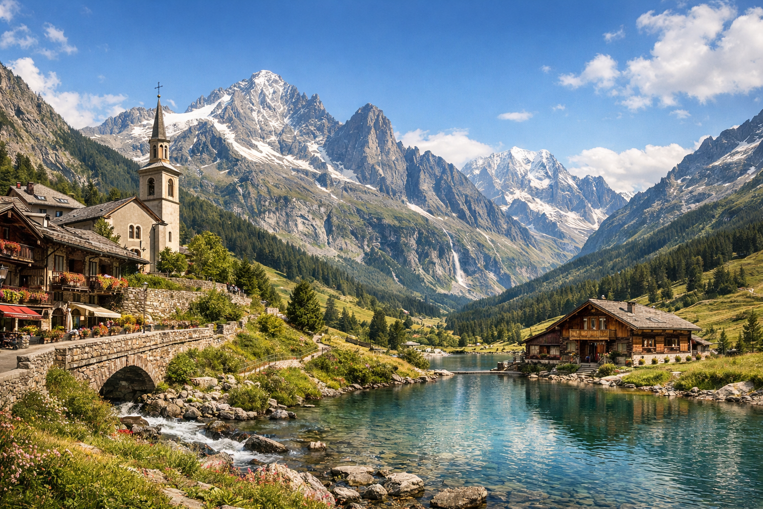
Circle Mont Blanc through flowered alpine meadows, high mountain passes, and storybook villages as France opens into Italy and Switzerland. In July and August, the classic ring from Les Houches to Courmayeur, La Fouly or Champex-Lac, and back feels alive with clear trails, wild scenery, and long summer light.

🥾 DAY-BY-DAY ROUTE

Ready-made country and city routes with daily plans, sights, transport and accommodation. Buy PDF guides for independent travel.

🥾 DAY-BY-DAY ROUTE


Day 1 — Les Houches: getting to know the valley and an easy start at Bellevue

  • 🥾 It’s best to make the first day an acclimatization day: head up to the Bellevue area above Les Houches and take a calm panoramic walk along grassy slopes and forest sections near the start of the classic Tour du Mont Blanc. The active part of the day usually takes 2.5–4 hours, difficulty is easy, distance is about 6–8 km, and elevation gain is moderate — around 200–350 m if you cover part of the ascent by cable car. This is a good day for an average traveler: the trails are well-known, popular, easy to follow, with no glacier and no mountaineering elements. Views open over the Chamonix valley, forests, and Mont Blanc ridges, and the pace of the walk helps you ease gently into the route. In July–August it’s important to start early: after midday it can get hot, and there is almost no shade on the upper open sections. The Bellevue cable car operates in summer depending on the weather, so it’s worth checking the lift status and the time of the last descent in the morning.


Day 2 — Les Houches: Parc de Merlet and a balcony trail above the valley

  • 🌲 Today is a beautiful walk through forest and a panoramic slope to Parc de Merlet, from where you can see the entire Mont Blanc massif. The park itself is known for its peaceful trails and the chance to see mountain animals in a safe area, and the approach to it is already a pleasant hiking day in its own right. The active part usually takes 3–5 hours depending on how you get there, difficulty is easy / moderate, distance is about 7–10 km, and elevation gain is 250–500 m. For an average traveler, the route is convenient because it follows clear roads and trails without technical sections; in July and August there is often a seasonal shuttle to the park, which makes the day even more comfortable. It’s better to go in the morning: the animals are more active and the light is softer for panoramas. After rain, the paths can be slippery, but they still remain a standard walking option with good footwear.

Day 3 — Les Contamines-Montjoie: forest walk to Notre-Dame de la Gorge

  • ⛪ After a short transfer to Les Contamines-Montjoie, spend a calm day on the lower part of the classic TMB: a walk from the village toward Notre-Dame de la Gorge and farther along the La Gorge – Les Granges – l’Étape trail. This is a very pleasant route through forest, a mountain stream, old pastures, and the valley. The active part is 2.5–4 hours, difficulty is easy, distance is about 6–9 km, and elevation gain is 150–350 m. For an average traveler, this is one of the safest and most straightforward sections in the region: a wide trail, a popular direction, many people in season, and simple navigation. In summer, the local shuttle to Notre-Dame de la Gorge is useful — it saves time and energy. In July–August, after heavy rains the streams are louder and some spots may be wet, so waterproof footwear is highly desirable.

Day 4 — Les Contamines-Montjoie: natural valley and the Les Contamines reserve

  • 🏞️ This day is dedicated to the valley, alpine meadows, and protected natural area near Les Contamines. Instead of a hard crossing over high passes, choose a gentler route along the lower and mid-level trails of the protected area, with a visit to the nature reserve sector and viewpoints above the valley. The active walk usually takes 4–5 hours, difficulty is moderate, distance is 8–11 km, and elevation gain is about 300–500 m. This kind of day suits an average traveler because you stay on marked summer trails without snowy passes and without the long exhausting climbs typical of the full TMB trek. It’s a good chance to feel the alpine scale — meadows, forest, flowing water, shepherd huts — but without the extreme element. In peak season, thunderstorms are possible after lunch, so it’s better to start in the morning and check trail conditions in the village in advance.

Day 5 — Courmayeur: a gentle move to the Italian side and a walk in Val Ferret

  • 🇮🇹 The transfer through the Mont Blanc Tunnel to Courmayeur is logically combined with a short walk in the lower part of Val Ferret. Here the character of the route changes: instead of a French forest valley, you find yourself in a broad mountain valley with meadows, larches, and a grand wall of peaks. The active part of the day is 2.5–4 hours, difficulty is easy, distance is about 6–8 km, and elevation gain is 100–250 m. This is a very friendly section for average travelers: you can walk on comfortable valley paths, avoid the higher technical traverses, and shorten the route at any moment. In July and August, seasonal buses usually operate in Val Ferret, which allows you to choose a convenient start and finish point. On warm clear days, the sun is strong here, so you need extra water and UV protection.

Day 6 — Courmayeur: panoramic trail to Rifugio Bonatti without hard options

  • ⛰️ The most beautiful day on the Italian side is the balcony trail in Val Ferret toward Rifugio Bonatti, but in a lighter format: with convenient access into the valley and a walk along the friendliest panoramic section. The character of the route is alpine pastures, a balcony trail, views of the Grandes Jorasses and the Mont Blanc massif. The active part usually takes 4–5.5 hours, difficulty is moderate, distance is about 9–12 km, and elevation gain is 350–550 m depending on the starting point. For an average traveler, this option is good because it stays on the well-known TMB trail without glaciers, ropes, helmets, or dangerous ridges; it’s simply important not to choose the higher and more difficult variants. If the weather worsens, the route is easy to shorten. In July–August this section is very popular, so it’s better to set out early — both for the quiet and for more stable weather before the afternoon clouds.

Day 7 — Courmayeur: Skyway Monte Bianco and a short walk near the Pavillon mid-station

  • 🚠 After two active days, make this a lighter sightseeing day: take the Skyway Monte Bianco and limit yourself to walks around Pavillon and the viewing terraces, without going into high alpine or snowy zones. The character of the day is high-mountain panoramas, short walking trails, scenic terraces, and botanical/exhibition areas at the mid-station. The active part is 1.5–3 hours, difficulty is easy, distance is 2–5 km, and elevation gain is minimal. This is a format that suits an average traveler perfectly: no mountaineering at all, just a beautiful mountain day with short safe walks and the possibility to relax. It’s important to remember that the top station has a temporary time limit for regular visitors, and cable car operations depend on the weather; strong winds may cause changes. A warm jacket is needed even in August because it is much colder up there than in the valley.

Day 8 — La Fouly: Swiss valley and an easy walk in Ferret

  • 🇨🇭 The transfer to Switzerland through the Orsières sector to La Fouly is best finished with a calm walk in the Ferret valley. This is a day about an alpine village, conifer forest, a river valley, and gentle pasture trails. The active part usually takes 2–4 hours, difficulty is easy, distance is 5–8 km, and elevation gain is 100–250 m. This format is ideal for an average traveler: after a day of logistics, there’s no need to take on a serious route, and the valley itself is very photogenic and relaxing. TMR public transport makes it possible to get here without a car, but the schedule should be checked in advance because intervals in mountain areas are not always frequent. In July–August the evenings are long, so even after the transfer there is still time for a proper walk.

Day 9 — Champex-Lac: lake, forest, and the Flore-Alpe botanical garden

  • 🌿 Today is one of the calmest and most beautiful days of the route: Champex-Lac, a walk around the lake, and trails to the Flore-Alpe alpine botanical garden. The character of the route is lake, forest, gentle paths, blooming mountain plants, and open views of Swiss peaks. The active part of the day is 2.5–4 hours, difficulty is easy, distance is about 5–7 km, and elevation gain is 100–200 m. This is an excellent recovery day for an average traveler: minimal exertion, maximum nature, good infrastructure, benches, cafés, and very straightforward logistics. In July the garden is especially beautiful because of the blooms, while in August the rich greenery and clear views remain. After rain, the trails around the lake remain passable, but an early start is more pleasant because of the soft light and calm atmosphere.

Day 10 — Les Houches / Chamonix Valley: Grand Balcon Nord in a safe format

  • 🏔️ As you return to the French side, devote the day to one of the valley’s most famous panoramic walks — Grand Balcon Nord in a lighter format between Plan de l’Aiguille and Montenvers, or a shorter section with a return. The character of the route is a high balcony trail, alpine grasses, views of the Chamonix Aiguilles, and glacier cirques in the distance, but without stepping onto the glacier itself. The active part takes 2.5–4 hours, difficulty is moderate, distance is about 6–8 km, and elevation gain is small, usually 150–300 m if using the lift. For an average traveler, the route is suitable because it is a famous marked trail without mountaineering challenges, as long as you don’t take more difficult side branches or try to combine it with extreme options. Very important: mountain weather changes quickly here, and it is cool at altitude even in summer. If cloud is low or thunderstorms are expected, it’s better to simplify this day.

Day 11 — Chamonix Valley: Lac Blanc from the Flégère/Index area as the final postcard of the route

  • 💙 The final day is an Alpine classic: Lac Blanc in the Aiguilles Rouges reserve, ideally via the ascent to the Flégère / Index sector to make the route realistic and manageable. The character of the walk is a mountain lake, a rocky but popular and well-known trail, panoramas of Mont Blanc, high alpine meadows, and viewpoints. The active part usually takes 4–5.5 hours, difficulty is moderate, distance is about 7–10 km, and elevation gain is 350–500 m depending on the starting point. For an average traveler, this is a suitable finale if you go in good weather, wear comfortable footwear, and don’t rush: the route is very popular, excellently marked, and does not require special gear, but it is still not a flat stroll. In July there may still be isolated snow patches beside the trail, while in August the bigger issue is usually the large number of people rather than snow. Swimming in Lac Blanc and nearby lakes is prohibited, and on the route you should stick to the markings and check lift operating hours in advance.

Flight tickets

eSIM for travel

Buy PDF guide

Buy PDF guide — 23.56 USD

PDF — 23.56 USD