
Buy PDF guide

Buy PDF guide — 15.00 USD

PDF — 15.00 USD

France and the Alpine Rings. Gr5 through Vanoise National Park. Season (July-September)

France and the Alpine Rings. Gr5 through Vanoise National Park. Season (July-September)

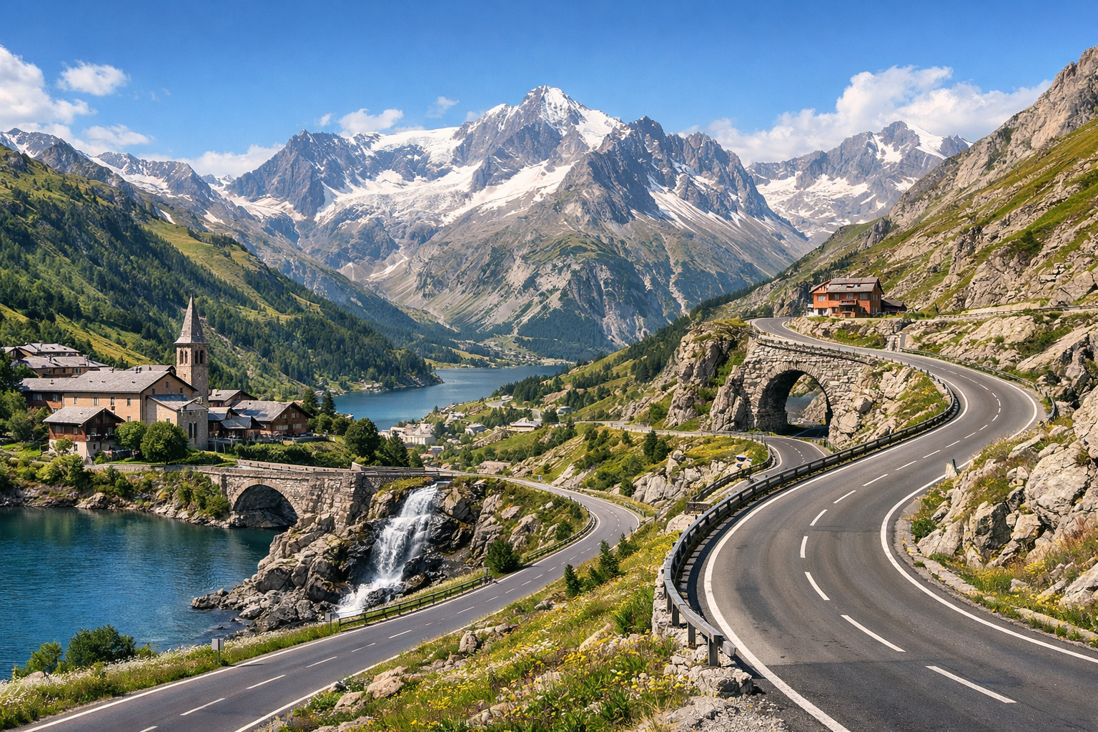
Cross high alpine passes and flower-filled meadows on this spectacular stretch of the GR5 through Vanoise National Park, linking Tignes with Pralognan-la-Vanoise and Termignon / Val-Cenis. From July to September, expect dramatic glacier views, turquoise lakes, and classic Savoyard villages beneath some of the French Alps’ most beautiful peaks.

🥾 DAY-BY-DAY ROUTE

Ready-made country and city routes with daily plans, sights, transport and accommodation. Buy PDF guides for independent travel.

🥾 DAY-BY-DAY ROUTE


Day 1 — Tignes: scenic GR5 section to Refuge du Col du Palet

  • 🥾 The first day is best devoted to gentle acclimatization in the upper Tarentaise: from Tignes Le Lac or Tignes Val Claret, follow the well-known and clearly marked trail toward Refuge du Col du Palet, one of the classic summer routes on the edge of Vanoise National Park. The character of the walk is high mountain meadows, lake shores, and panoramic views. The active part of the day usually takes 4–5 hours round trip, approximately 9–11 km, with about 500–650 m of elevation gain, difficulty moderate. It is a good day for an ordinary tourist: the trail is popular, easy to follow, with no glacier, no rocky sections, and no need for a helmet or rope protection. Along the way, there are views of the Tignes reservoir, grassy slopes, and the rugged peaks of Vanoise, and at the refuge you can take a long break for photos and a snack. In summer, from July to September, the route is especially convenient, but in early July there may still be patches of snow on shaded sections, and afternoon thunderstorms are not uncommon, so it is better to start early in the morning. If you want to make the day easier, pedestrian lifts operate in Tignes and can sometimes reduce the elevation gain, but opening hours should be checked in advance.


Day 2 — Transfer to Pralognan-la-Vanoise and a walk to Maison de la Vanoise

  • 🥾 This day is intentionally made lighter and more realistic: a morning transfer from Tignes to Pralognan-la-Vanoise, and after check-in, a short nature walk along the valley and a visit to Maison de la Vanoise, the village’s main visitor center. The character of the day is an alpine valley, forest sections, a river, and getting acquainted with the park. The active part takes 1.5–3 hours, the distance is usually 4–7 km, elevation gain is minimal, and the difficulty is easy. This kind of day suits ordinary tourists after the road: no extreme climbs, simple navigation, and the option to adjust plans according to the weather. At the visitor center, it is worth checking trail conditions, any temporary closures, and local park rules. An important seasonal detail: in July–September it can be warm and sunny in the valley during the day, but it cools down quickly in the evening, and in rainy weather forest trails become slippery. It is a good day to ease into the rhythm of hiking before longer walks.

Day 3 — Pralognan-la-Vanoise: Lac des Vaches via the classic GR55 route

  • 🥾 One of the most beautiful and still accessible days of the route is the walk from the Les Fontanettes area to Lac des Vaches, the famous lake with a stone path across the water. The character of the route is forest, mountain valley, pastures, a glacial lake, and Vanoise panoramas. The active part usually takes 4–6 hours round trip, approximately 10–12 km, with about 450–650 m of elevation gain, difficulty moderate. This is a very successful route for an ordinary tourist: the trail is official, well known, well trodden, without technical alpine obstacles and without mandatory special equipment. The main reward is Lac des Vaches itself, reflections of rocky slopes, a pastoral atmosphere, and the feeling of the true French Alps without needing to commit to a harsh high-altitude trek. It is only important to remember the seasonality: in early July, patches of snow above the lake may still remain, and on rainy days the stones and footbridges can be slippery. If you feel tired, there is no need to continue higher toward Col de la Vanoise — the section up to the lake already makes for a full and very photogenic hiking day.

Day 4 — Pralognan-la-Vanoise: Mont Bochor and the scenic descent trail

  • 🥾 The fourth day is a panoramic walk with the help of the Mont Bochor cable car, allowing you to see Vanoise from above without a heavy climb. The character of the walk is viewpoints, alpine meadows, short mountain paths, and wide views of valleys and peaks. The active part takes 2.5–4 hours, the distance is usually 5–8 km; if you go up by cable car and walk down along the marked trail, you get about 600 m of descent without a strenuous ascent, difficulty easy or easy-moderate. This format is ideal for an ordinary tourist: minimal risk, great views, a comfortable pace, and the option to end the walk earlier if the weather worsens. On the route there is a table d’orientation and impressive views of Grande Casse and the Vanoise massif. A summer detail: the cable car operates only in season, so its opening hours should be checked in advance, and even in August it can be windy and cool at the top. This day provides a nice change of rhythm after Lac des Vaches and leaves energy for the next transfer.

Day 5 — Transfer to Termignon / Val-Cenis and a walk to Refuge de Plan du Lac

  • 🥾 After the transfer to Termignon / Val Cenis, it is worth choosing one of the friendliest routes in the southwestern part of Vanoise — a walk from Parking de Bellecombe or the free shuttle to Refuge de Plan du Lac and across the scenic plateau. The character of the walk is a high mountain plateau, alpine meadows, streams, rugged peaks, and wide glacial panoramas. The active part of the day takes 2.5–4 hours, the distance is usually 6–8 km, with about 150–300 m of elevation gain, difficulty easy. This is an especially good route for ordinary tourists: the approach is short, the trails are popular and very straightforward, there is a refuge-porte of the park, and the area itself is known as a convenient place to discover Vanoise without a long high-mountain expedition. In summer, marmots may be seen here and there are views of glaciers, but in bad weather the open spaces are quickly swept by wind. In July and early August the sun on the plateau is strong, so water, a hat, and sun protection are necessary. If the shuttle runs on the seasonal schedule, it is a convenient way to shorten the road approach and avoid worrying about parking.

Day 6 — Termignon / Val-Cenis: Boucle du Lac Blanc face aux glaciers

  • 🥾 This day is devoted to one of the region’s best calm panoramic walks — Boucle du Lac Blanc in the Plan du Lac area. The character of the route is a mountain plateau, a lake, flowering meadows, streams, and distant glacier views. The active part usually takes 2–3.5 hours, the distance is about 4–6 km, the elevation gain is small — around 100–200 m, difficulty easy. This is a route that suits an ordinary tourist especially well: it is short, scenic, logically laid out for navigation, and requires neither experience nor special equipment. In clear weather, the landscape looks almost postcard-perfect: calm water, grassy slopes, and the contrast of greenery with snow patches on distant peaks. A seasonal note — even in summer, the weather can change abruptly here, with fog and strong wind, so a windproof jacket is essential. If the morning is overcast, it is better to shift the start slightly: in sunshine this route feels much more vivid.

Day 7 — Val-Cenis / Mont Cenis: Fort de Ronce and the Mont Cenis lake plateau

  • 🥾 The final day is a beautiful and not too difficult hike in the Mont Cenis area: a walk along the Sentier des 2000 to Fort de Ronce with a possible extension along the lake plateau and through the Jardin alpin du Mont-Cenis. The character of the walk is a high mountain lake, grassy plateau, historic forts, flowering alpine meadows, and wide views of the French-Italian border. The active part of the day usually takes 3–4.5 hours, approximately 7–10 km, with about 250–500 m of elevation gain, difficulty easy or moderate depending on the loop length. This is a good finishing route for ordinary tourists: the trail is well known, with no technical sections, and the high-altitude beauty is combined with relatively gentle terrain. In summer, July and August are especially good here when alpine plants are in bloom, but even in September the plateau remains very picturesque. Seasonal nuances: the pass is windy, the weather changes quickly, and by late September the days are already noticeably shorter, so it is not worth postponing the start until the second half of the day. An excellent finale to a journey through the Alpine loops and the most accessible natural sections around the GR5/GR55 via Vanoise.

Flight tickets

eSIM for travel

Buy PDF guide

Buy PDF guide — 15.00 USD

PDF — 15.00 USD