
Buy PDF guide

Buy PDF guide — 16.90 USD

PDF — 16.90 USD

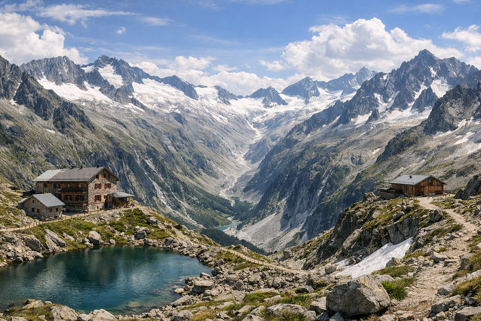
Austria, Tyrol. The Berliner Höhenweg is a challenging high-mountain trek through the Zillertal Alps with crossings over mountain passes, glacier panoramas, and overnight stays in mountain huts. Difficulty: high. Season: July - September.

Austria, Tyrol. The Berliner Höhenweg is a challenging high-mountain trek through the Zillertal Alps with crossings over mountain passes, glacier panoramas, and overnight stays in mountain huts. Difficulty: high. Season: July - September.

Tyrol’s Berliner Höhenweg is a demanding alpine trek through the wild heart of the Zillertal Alps, linking high passes, dramatic glacier views, and classic mountain huts. Best tackled from July to September, this route leads from Mayrhofen into a spectacular world of rock, ice, and unforgettable high-altitude scenery.

🥾 DAY-BY-DAY ROUTE

Ready-made country and city routes with daily plans, sights, transport and accommodation. Buy PDF guides for independent travel.

🥾 DAY-BY-DAY ROUTE


Day 1 — Mayrhofen: easy acclimatization walk on the Ahorn Plateau

  • 🥾 On the first day, it’s better not to push for altitude, but to ease gently into the rhythm of the valley. Ride up from Mayrhofen to Ahorn and take a simple walk along the wide scenic paths of the plateau. This is the character of the walk: alpine meadows, forest sections, and panoramic viewpoints. The active part of the day usually takes 2.5–4 hours at a relaxed pace, depending on the loop you choose. Difficulty is easy; distance is usually 5–8 km, with only a small elevation gain if you take the main ascent by cable car. This day is suitable for an average traveler because the routes here are popular, well marked, glacier-free, without scree passes, and require no special equipment. Along the way, you get gentle views over the Zillertal valley and the mountain slopes, and the format of the walk helps you understand the weather, your pace, and trail conditions before the following days. Seasonal note: in July and August it can be hot down below during the day, so it’s more comfortable to start in the morning; after rain, wooden boardwalks and roots can be slippery; the cable car runs seasonally, so it’s worth checking the schedule in advance.


Day 2 — Ginzling: nature walk in Hochgebirgs-Naturpark Zillertaler Alpen

  • 🌲 Today’s route is devoted to the nature park, valley, and forest trails by a mountain river. From Mayrhofen, it’s easy to take a bus to Ginzling and start the day at the Naturparkhaus, where you can check current trail conditions. Then take one of the easy walks along the valley floor and forest sections around the village: this is a calm day with 3–5 hours of active walking, usually 6–10 km with a moderate or small elevation gain of up to 150–300 m. Difficulty is easy / moderate. This area is especially good as a safe alternative to the high-alpine Berlin High Trail: you are still in the heart of the same mountain system, but walking on clear lower routes without exposed sections, without rope protection, and without the need to overnight in huts. The scenery here is very Tyrolean: a noisy river, conifer forest, wet meadows, wooden footbridges, and valley walls rising toward high peaks. Seasonal notes: in summer, trails near the water may be damp after rain; on hot days, this option is more comfortable because of the shade; in September, mornings are cooler, but visibility is often better.

Day 3 — Schlegeis: walk along the turquoise reservoir

  • 💧 One of the most beautiful and at the same time accessible days of the route. Take bus 4102 or drive up to Schlegeis Stausee via Zemmgrund. Here you’ll find a lake walk in a high mountain valley with no need to enter the technical sections of the Berlin High Trail. You can choose a linear or partly circular format along lakeside paths and wide trails near the water. The active part usually takes 3–5 hours; a reasonable distance for an average traveler is 7–12 km, with elevation gain most often around 100–300 m. Difficulty is easy / moderate. The route is suitable without special equipment because the start is already high thanks to the alpine road approach, and the main walking sections follow popular, straightforward, and well-frequented paths. Along the way there are distant glacier panoramas, waterfalls, gray-green slopes, and vivid water color. Important seasonal notes: the road to Schlegeis is listed as open in 2026 from mid-May to late October; bus access is most convenient from June to September; from July to September the weather in the upper valley changes quickly, so bring a rain jacket and a warm layer even on a sunny day.

Day 4 — Schlegeis / Breitlahner: hike to Berliner Hütte as a safe fragment of the region

  • 🏔️ On this day, you touch the history of the Berlin route, but in a safe format. From Alpengasthaus Breitlahner, follow the well-known trail to Berliner Hütte and back. This is a valley-mountain trail through forest and alpine pastures, not a dangerous high traverse. Officially, the ascent to the hut takes about 3 hours one way, so the active part of the day is usually 5.5–7 hours round trip. Distance is approximately 16–18 km, with elevation gain around 750–850 m. Difficulty is moderate. For an average traveler with good basic fitness, the route is realistic: the trail is popular, marked, glacier-free, with no helmet, no ferrata, and no mandatory alpine technique. The reward is one of the most atmospheric mountain huts in Tyrol, the broad Zemmgrund valley, streams, conifer forest, and a gradual transition into a harsher alpine landscape. Seasonal notes: start early because the day is long; after heavy rain and early in the season, rocky sections can be wet; if the forecast is unstable, it’s better to shorten the plan to a shorter walk in Zemmgrund.

Day 5 — Stilluptal: a gentle rest day with a valley walk

  • 🌿 After a longer day, it’s time for a comfortable hike with a beautiful backdrop. Head to Stilluptal — one of the calmest side valleys of Mayrhofen. This day is about a green valley, river, pastures, waterfalls, and wide walking roads. From Mayrhofen, a bus/shuttle runs here at least until mid-October, so you can choose a very flexible format: a short walk of 2–3 hours or a longer day of 4–5 hours. Distance is usually 6–12 km, with elevation gain of 100–250 m. Difficulty is easy. This day is especially suitable for an average traveler: there are no steep climbs, the route is easy to shorten, and return logistics are simple by public transport or on foot. The landscape here is softer than at Schlegeis: a pastoral valley, lush grass, farms, water, and open views of the surrounding peaks. Seasonal notes: in summer the valley is very pleasant in mixed weather, but check the last bus in advance; in hot weather bring water, as part of the route crosses open sections.

Day 6 — Mayrhofen / Zillergrund: lake and scenic paths near Speicher Zillergründl

  • 🏞️ Today the route takes you into another side gorge of the region — Zillergrund. This is a walk in the format of a mountain valley, reservoir, panoramic road, and calm lookout sections. From Mayrhofen, people usually get here by bus 8328 or by car. For an average traveler, it’s best to choose safe walking options near the reservoir and along the valley, without trying to go up to high passes. The active part of the day is 3–5 hours, distance 7–11 km, with elevation gain more often around 150–350 m. Difficulty is easy / moderate. The day is suitable without special equipment because the main routes here follow known valley trails and service roads, not high-alpine terrain. The views differ from Stilluptal: a stricter valley shape, rich water color, the scale of the engineered landscape, and beautiful perspectives toward the side slopes. Seasonal note: check the bus schedule back, because frequency may be lower than on the main lines; in fog or rain this is still a good day, as the walk remains fairly easy.

Day 7 — Tux / Hintertux: Schleierwasserfall waterfall

  • 💦 Move to the Tux valley and devote the day to a waterfall trail, forest, and mountain meadows. One of the best accessible options is the route to Schleierwasserfall near Hintertux. This is a spectacular but not extreme walk for those who want to feel mountain terrain without mountaineering. The active part usually takes 2.5–4 hours; distance is often 5–8 km, with elevation gain around 200–400 m depending on the exact start and return plan. Difficulty is moderate. Why it suits an average traveler: the trail is well known, popular, and a day hike, and it can be done without a tent and without special gear; all you need are good boots, caution on wet sections, and normal fitness. Along the way there is the sound of falling water, green slopes, streams, cool forest air, and striking views of this natural monument. Seasonal notes: after rain, stones and roots become slippery; the waterfall is especially powerful in warm weather and after precipitation; during a thunderstorm, it’s better not to linger in exposed places.

Day 8 — Hintertux: easy panoramic walk by the glacier without stepping onto the ice

  • ❄️ It’s worth making the final day memorable but safe. Use the Hintertuxer Gletscher lifts for a panoramic walk in an equipped high-mountain zone without going onto the glacier itself and without mountaineering tasks. A good format is short scenic routes near the upper stations, viewpoints, and, if you wish, a visit to Nature’s Ice Palace as an organized attraction rather than an independent walk on ice. The active walking part of the day is usually 1.5–3 hours, distance 3–6 km, with only a small elevation gain thanks to the cable cars. Difficulty is easy. This suits an average traveler because the walk takes place in a controlled area with clear logistics, not in wild high-alpine terrain; the only important thing is not to leave marked or open areas. Seasonal notes: even in summer it is noticeably colder here, so you need a warm layer and wind protection; clouds, snow, or limited visibility are possible; the lifts and some attractions operate on schedules, and some activities require booking.

Flight tickets

eSIM for travel

Buy PDF guide

Buy PDF guide — 16.90 USD

PDF — 16.90 USD